
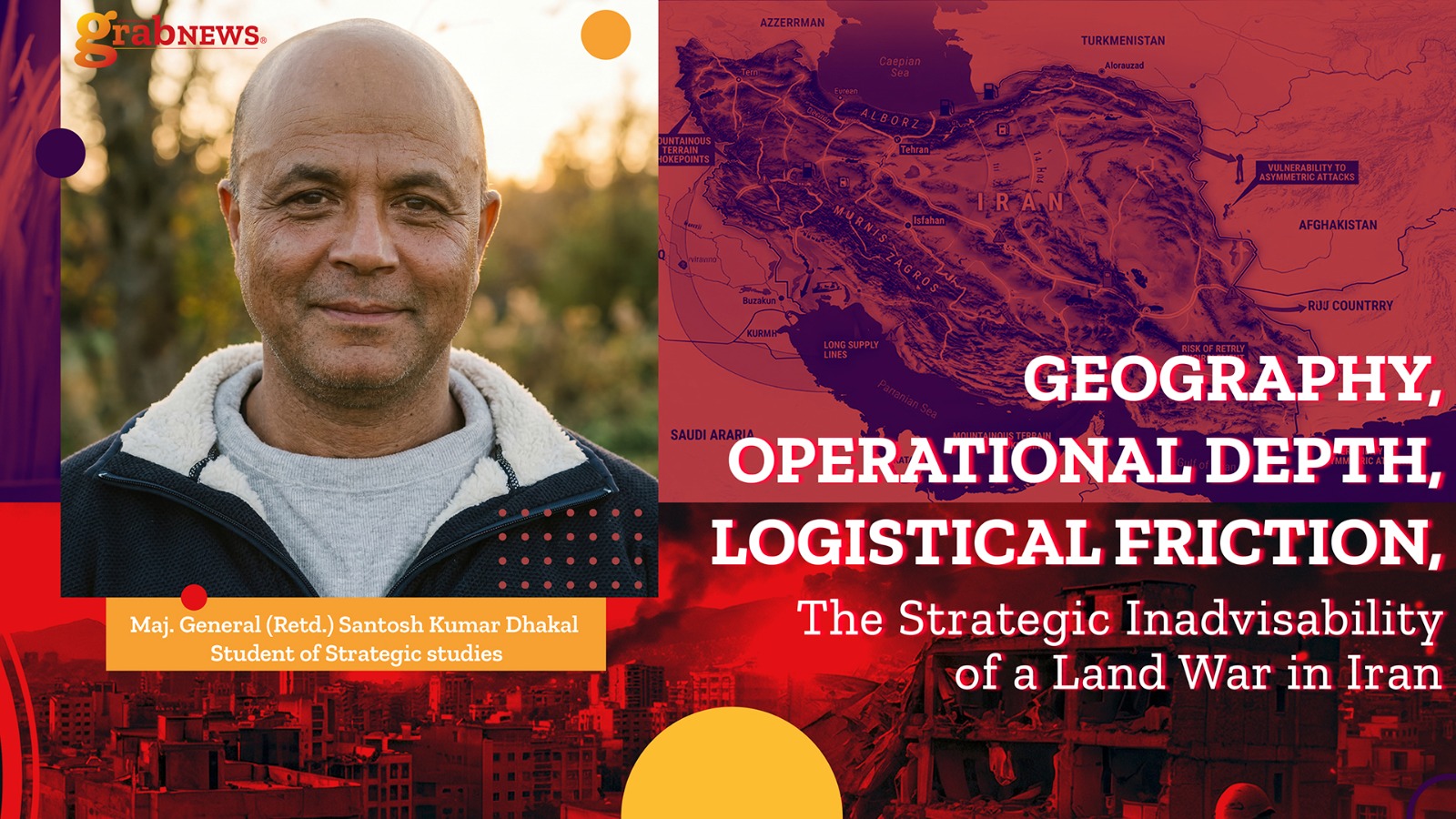
Abstract
Iran’s geography exemplifies the profound influence of terrain and environment on operational art. Spanning approximately 1.65 million km², the Iranian plateau features the Zagros Mountains (~1,500 km) in the west, Alborz Mountains (~1,100 km) in the north, and two of the harshest deserts in the world: Dasht-e Kavir (~77,600 km²) and Dasht-e Lut (~51,800 km²). These geographic features provide exceptional operational and geographic depth, shaping how campaigns are conceived, conducted, and sustained. Mountains constrain mobility and concentrate forces into narrow corridors, while deserts impose extreme environmental friction through heat, sand, and water scarcity. Together, these features compel attackers to plan for extended campaign timelines, dispersed troop formations, and complex logistical requirements, rendering any large-scale land war in Iran exceedingly costly in terms of time, resources, and personnel. This paper examines the strategic effects of Iran’s mountains and deserts, historical operational failures in comparable environments, the limitations of modern technology, and draws inferences on why geography alone provides a persistent defensive advantage.
Introduction: Geography as the Ultimate Constraint
In military theory, friction—a concept highlighted by Clausewitz—refers to the aggregate of all factors that reduce operational efficiency: distance, terrain, weather, and logistical complexity. Iran’s geography amplifies friction to extremes. The plateau’s mountains, deserts, and expansive territory systematically constrain movement, force dispersion of forces, complicate supply lines, and slow operational tempo. In practical terms, Iran is not merely a large state—it is a natural fortress where terrain shapes operational art as much as strategy or doctrine.
Figure 1 (see below) visually illustrates the interrelation of Iran’s mountains, deserts, and historical invasion corridors, highlighting how terrain naturally directs invading forces into narrow avenues of approach.
Figure 1: Strategic Map of Iran

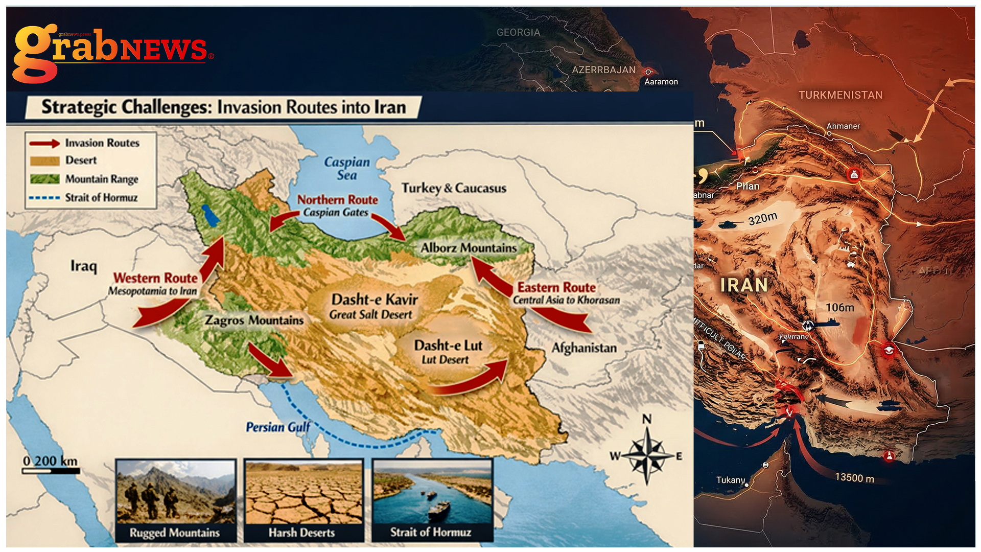
Key geographic features of Iran, including the Zagros Mountains, Alborz Mountains, Dasht-e Kavir, and Dasht-e Lut, alongside the Western (Zagros), Northern (Caspian Gates), and Eastern (Khorasan) invasion corridors. These features illustrate natural chokepoints and operational depth that constrain military campaigns.
Operational Depth: Time, Terrain, and Troop Sustainment
Operational depth refers to the extension of military operations across time, space, and sustainment requirements. Iran’s mountains and deserts magnify these factors:
Mountains: Constraining Mobility and Consuming Forces
The Zagros and Alborz mountains dominate the western and northern approaches. Their steep slopes, deep valleys, and limited passes reduce mechanized mobility and force attackers into predictable avenues of approach. Historical campaigns repeatedly show mountains “eat troops” by slowing movement, complicating coordination, and generating attrition. Narrow passes concentrate forces, creating natural chokepoints where defenders can inflict disproportionate losses. Logistics are heavily burdened: transporting armored vehicles, artillery, and fuel becomes extremely challenging. Historical analogies—from Alpine operations (WWI) to the Soviet-Afghan War—illustrate how mountainous terrain systematically favors defenders.
Deserts: Environmental Friction and Logistical Nightmares
Iran’s deserts—Dasht-e Kavir and Dasht-e Lut—introduce additional environmental friction:
- Extreme heat (up to 70°C in Lut) threatens personnel and vehicles.
- Salt crusts, dunes, and marshes complicate mechanized mobility.
- Water scarcity and navigation challenges extend supply lines and vulnerability.
The North African Campaign (WWII) provides a historical precedent: extreme heat melted rations (e.g., butter), fatigued troops, and degraded equipment. Iran’s deserts produce similar challenges but on a vastly larger scale, amplifying logistical burdens and operational timelines.
Temporal and Sustainment Depth
Iran’s 1.65 million km² forces campaigns to consider extended timelines and dispersed operations. Mountain passes slow columns; deserts require additional time for resupply and vehicle maintenance. Logistics stretching hundreds of kilometers are vulnerable to attrition or sabotage. The combination of environmental, temporal, and spatial constraints creates operational depth favoring defense.
Historical Operational Lessons
Several historical campaigns highlight the challenges of mountain and desert warfare:
- Afghanistan (1979–1989, 2001–2021): Mechanized forces constrained by rugged terrain, dispersed insurgents, and long supply lines.
- North African Campaign (1940–1943): Desert heat, sandstorms, and extended supply lines imposed severe strain.
- Alpine Front (WWI): Narrow passes and steep slopes slowed movement and amplified defensive advantages.
These examples underscore that terrain friction and attrition significantly favor defenders. Iran’s combination of mountains and deserts magnifies these historical lessons.
Limitations of Modern Technology
Even advanced systems face constraints:
- Mountains: Troop dispersal, terrain masking, and line-of-sight obstruction reduce the effectiveness of drones and ISR.
- Deserts: Vastness and sandstorms degrade sensor performance and reduce persistence.
Technology cannot fully overcome the logistical friction imposed by geography, confirming that operational art remains terrain-dependent.
Strategic Implications: Iran vs. Afghanistan
Comparing Iran with Afghanistan illustrates the operational challenge:
- Scale: Iran is roughly 2.5 times larger.
- Mountains: Longer, higher, and more extensive ranges.
- Deserts: Over 120,000 km² of extreme arid terrain.
- Operational Depth: Greater distances between strategic objectives magnify logistical strain.
While Afghanistan repeatedly frustrated invaders, Iran’s geography exponentially increases resource, time, and personnel requirements, producing higher operational friction.
Deserts and Mountains as Operational Anchors
Iran’s mountains and deserts function as anchors of operational design:
- Mountains anchor defensive positions, concentrating attackers into narrow passes.
- Deserts anchor logistics, stretching supply lines and increasing vulnerability.
These features act as natural multipliers for friction, increasing attrition, delay, and operational cost, which must be factored into campaign planning.
Strategic Friction and the Inadvisability of Land War
Friction dominates the operational calculus:
- Mobility Friction: Mountains and deserts slow movement, limit concentration.
- Logistical Friction: Extended supply lines are vulnerable and resource-intensive.
- Attritional Friction: Heat, sand, and elevation reduce combat effectiveness.
- Technological Friction: Terrain and vastness limit the effectiveness of drones and precision systems.
Collectively, friction makes conventional land operations prohibitively costly, favoring defenders and increasing the strategic risk of offensive operations.
Conclusion
Iran’s terrain—mountains, deserts, and vast interior—creates a natural defensive depth. Operational and geographic depth extends timelines, disperses forces, and magnifies logistical demands. Historical analogies from mountains and deserts, coupled with the limitations of modern technology, highlight the persistent advantage of defenders. Any land war in Iran would be time-consuming, resource-intensive, and extremely challenging, underscoring the enduring strategic maxim that geography is among the most effective defenders in warfare.
Selected References
Clausewitz, Carl von. On War.
Van Creveld, Martin. Supplying War: Logistics from Wallenstein to Patton.
Keegan, John. The Face of Battle.
Atkinson, Rick. An Army at Dawn: The War in North Africa.
Gray, Colin S. Modern Strategy.
Dupuy, Trevor. Understanding War: History and Theory of Combat.
Wikipedia contributors. Dasht-e Kavir and Lut Desert.
United States Army Field Manual. Mountain and Desert Warfare Operations.