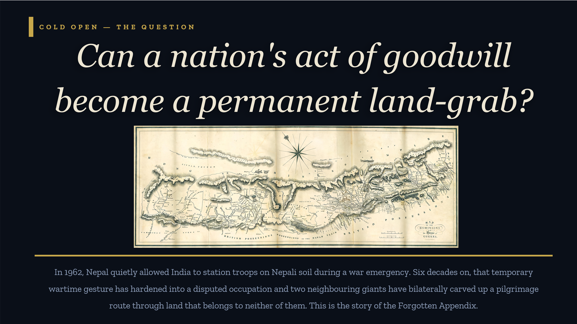
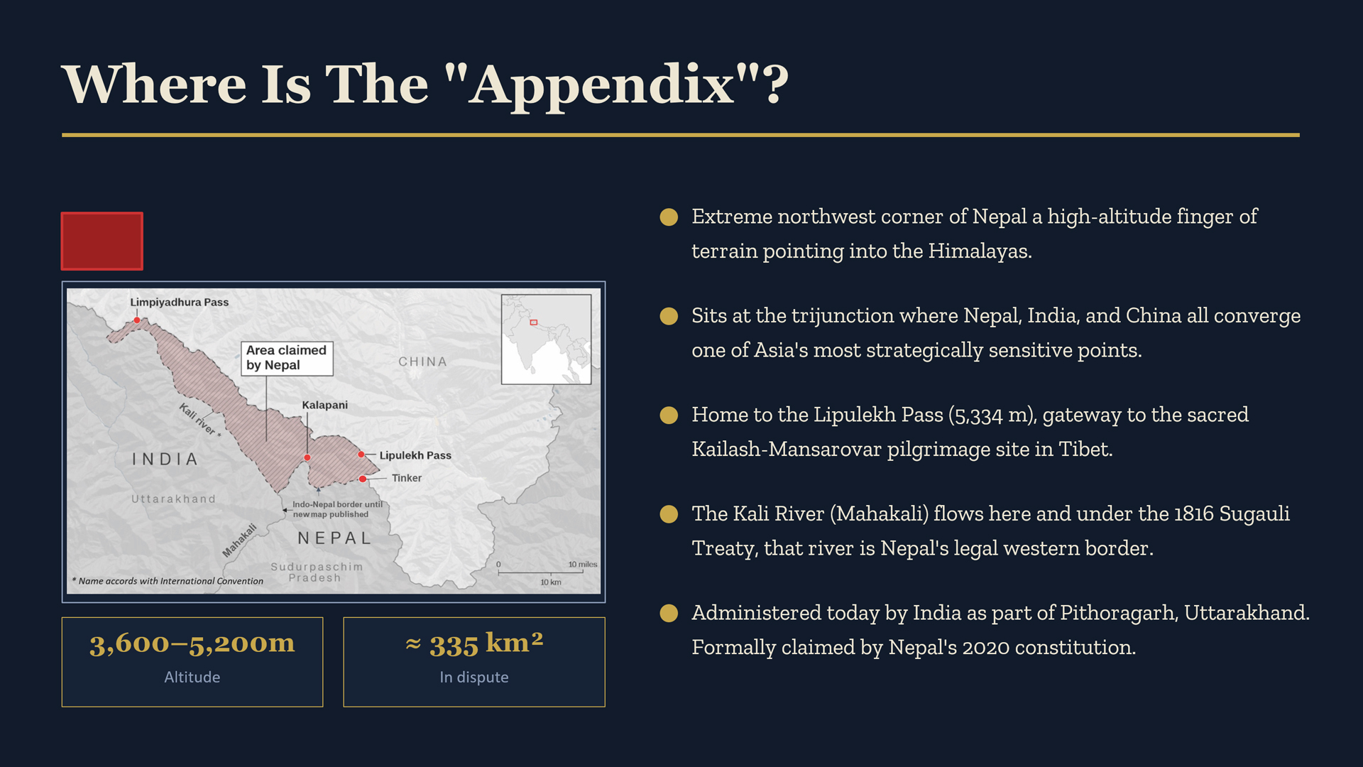
 Look at the map of Nepal carefully. Stretching across the roof of South Asia like a long, narrow corridor broader in the middle, tapered at the ends it is a country shaped by the grand compression of the Himalayas and the political settlements of the nineteenth century. But look more carefully at the far northwest corner, and you will see it: a small, finger-like protrusion pointing upward into the mountains, straddling the trijunction of Nepal, India, and China. This is the Kalapani-Limpiyadhura-Lipulekh triangle. To the cartographers of colonial British India, it was unambiguously Nepali. To Kathmandu, it remains so to this day. And yet, for more than six decades, it has been administered by New Delhi a quiet, persistent occupation dressed in the diplomatic language of strategic necessity. This is not merely a border quarrel between neighbours. It is the story of how a nation’s act of goodwill was slowly transformed into acquiescence, and how acquiescence was then reclassified as abandonment. Nepal has been too patient, too polite, and too hesitant to shout what its maps, its treaties, and its history say with unmistakable clarity: this land is ours.
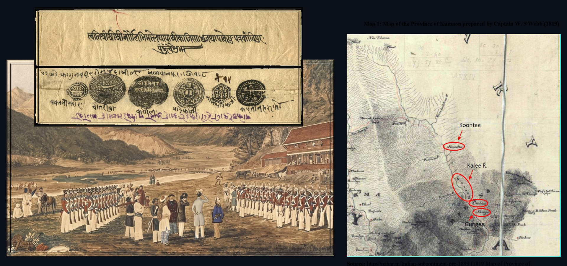

The foundation of Nepal’s claim rests on a single, unambiguous legal instrument: the Treaty of Sugauli, signed on March 4, 1816, between the Kingdom of Nepal and the British East India Company following the Anglo-Nepal War. Article 5 of that treaty is pellucidly clear it established the Kali River, known downstream as the Mahakali, as the western boundary of Nepal. All territory lying to the east of this river belongs to Nepal. All territory to the west was ceded. The crux of the dispute, therefore, lies in a seemingly technical but profoundly consequential question: where does the Kali River begin? Nepal’s position, buttressed by a body of historical evidence spanning two centuries, is that the river originates at Limpiyadhura, in the high Himalayas at the northwestern tip of the country. If Limpiyadhura is the source and cartographic, hydrological, and historical evidence strongly supports this — then Kalapani and Lipulekh, which lie to the east of the river’s course, are unambiguously Nepali territory under the very treaty that India itself inherited from its British predecessor.
“A review of maps prepared by the Survey of British India from 1816 through 1880 consistently reveals that the Kali River originates from Limpiyadhura making everything east of it, including Kalapani and Lipulekh, the sovereign territory of Nepal.”
This is not a marginal or contested academic position. Multiple surveys conducted under the British Raj itself in 1819, 1827, 1830, 1834, 1835, 1837, 1846, 1856, and 1860 all locate the river’s source at Limpiyadhura. Even the ‘Old Atlas of China,’ published during the Qing Dynasty in 1903, marks Limpiyadhura as the source of the Kali River and inscribes the word “Nepal” in Chinese characters across the northeastern bank. India’s own historical predecessor, the British Empire, repeatedly affirmed what Nepal now claims. The manipulation of this cartographic legacy by post-independence Indian administrations represents not just an error, but a deliberate reinterpretation of colonial-era evidence to suit contemporary strategic interests.
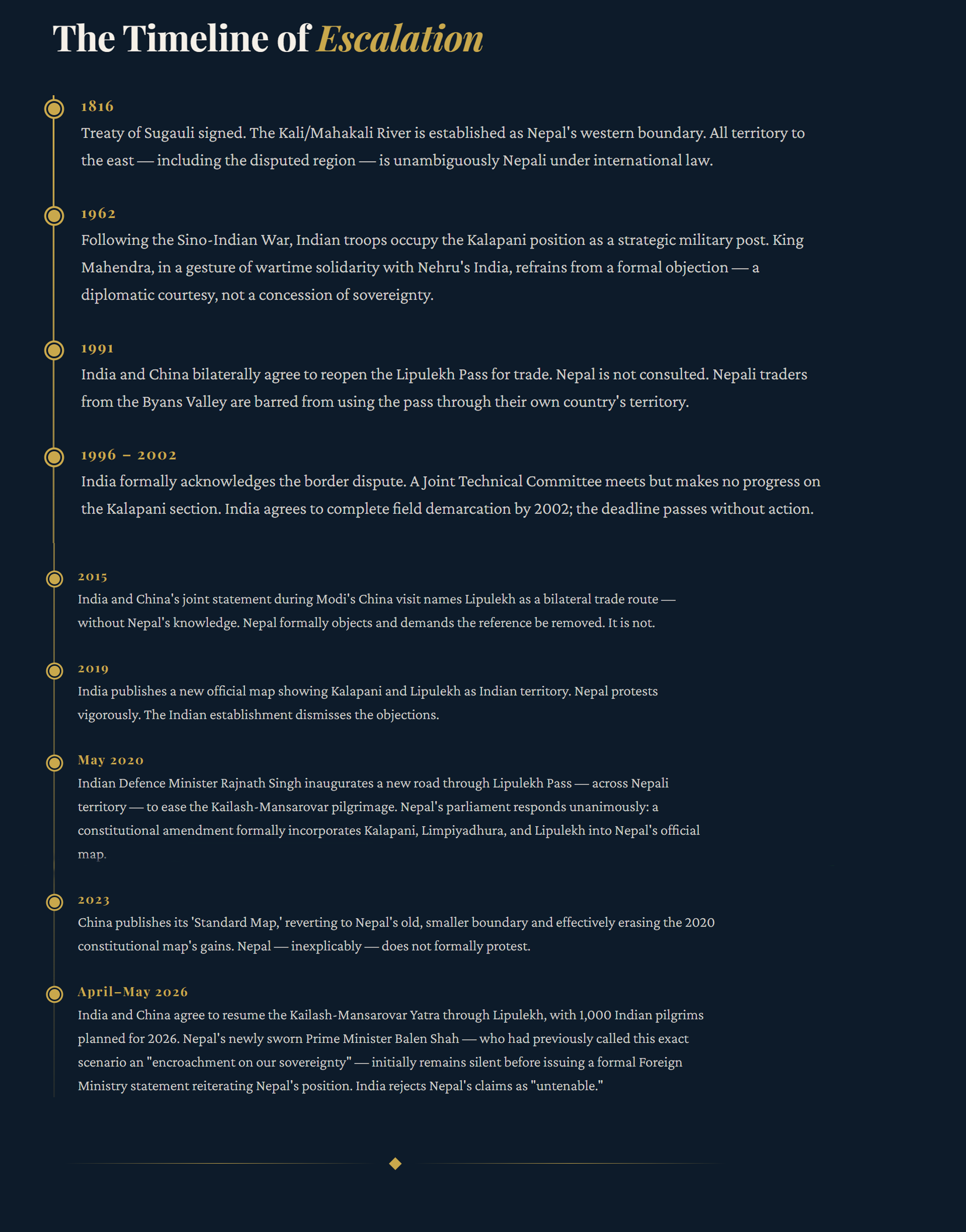
 The story of how India came to occupy Kalapani physically is inseparable from the geopolitical earthquake of the 1962 Sino-Indian War. When Chinese forces swept through Indian positions in the eastern and western Himalayas, New Delhi scrambled to fortify every strategic mountain pass it could reach. The Lipulekh Pass commanding the direct overland route to Tibet and the Kailash-Mansarovar pilgrimage site was of obvious military value. Indian troops moved in. King Mahendra of Nepal, ruling at a time of extraordinary delicacy, was presented with a fait accompli by his powerful southern neighbour.
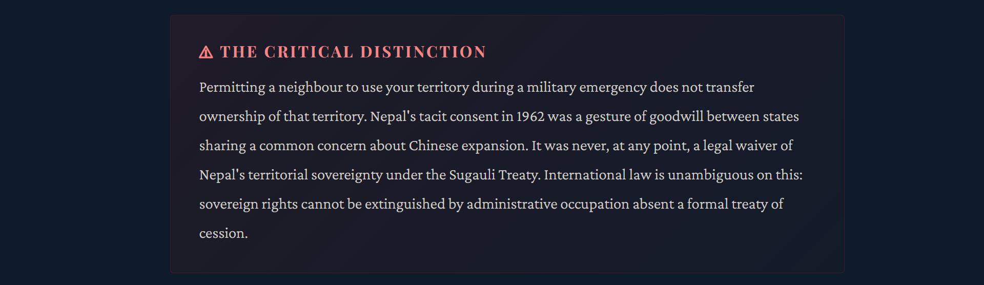
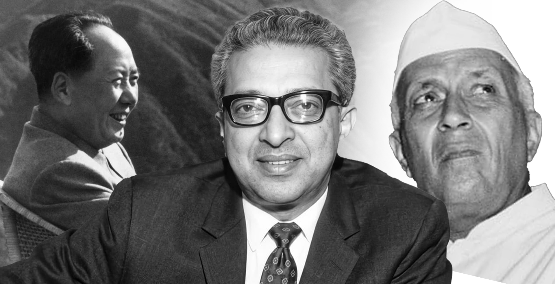 India, panicked and humiliated by the Chinese advance, needed the Kalapani position. Nehru’s government was in crisis. In the spirit of neighbourly solidarity and perhaps with an unspoken understanding that this was a temporary wartime measure Nepal’s sovereign objection was set aside. This was an act of diplomatic generosity, not a surrender of sovereign title.
What followed over the next six decades was a masterclass in the politics of incrementalism. India did not announce an annexation. Instead, it simply stayed. Military outposts became permanent installations. Revenue records were produced, dating from the 1830s, claiming Kalapani had been administered as part of Pithoragarh district of British Kumaon. Maps were redrawn. The 1962 wartime arrangement was gradually recast in Indian official discourse as a settled administrative reality. Nepal’s polite diplomatic notes, filed and forgotten, were used as evidence not of a live territorial dispute, but of Nepal’s inability to prove its case.

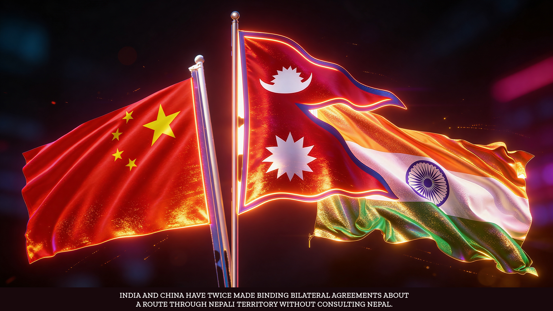
If the creeping occupation of Kalapani was the wound, the India-China bilateral agreements on Lipulekh have been the salt rubbed repeatedly into it. In 1991, India and China agreed to reopen the Lipulekh Pass for trade without consulting Nepal, the sovereign power whose territory the pass commands. Nepali traders from the Byans Valley, who had historically used this very pass for commerce with Tibet, were barred from entering the area India had now designated a strategic military zone. The affront was repeated in 2015, when India and China issued a joint statement during Prime Minister Modi’s visit to Beijing, explicitly naming Lipulekh Pass as a designated trading entrepôt between the two countries. Nepal immediately protested, demanding that both nations remove the reference from their joint communiqué, correctly arguing that it threatened Nepali sovereignty and territorial integrity. Neither India nor China complied. Then came May 2020 the moment that finally jolted Nepal’s political class into action. Indian Defence Minister Rajnath Singh inaugurated a newly built road connecting the Lipulekh Pass to the Indian plains, designed specifically to ease the Kailash-Mansarovar pilgrimage route. The road traversed territory that Nepal’s own constitution and parliament had affirmed as Nepali. For Nepali citizens, it was a rude awakening. Nepal’s parliament responded swiftly and unanimously: a new constitutional map was adopted, incorporating Kalapani, Limpiyadhura, and Lipulekh within Nepal’s official boundaries. India called it an “artificial claim.” The irony was complete.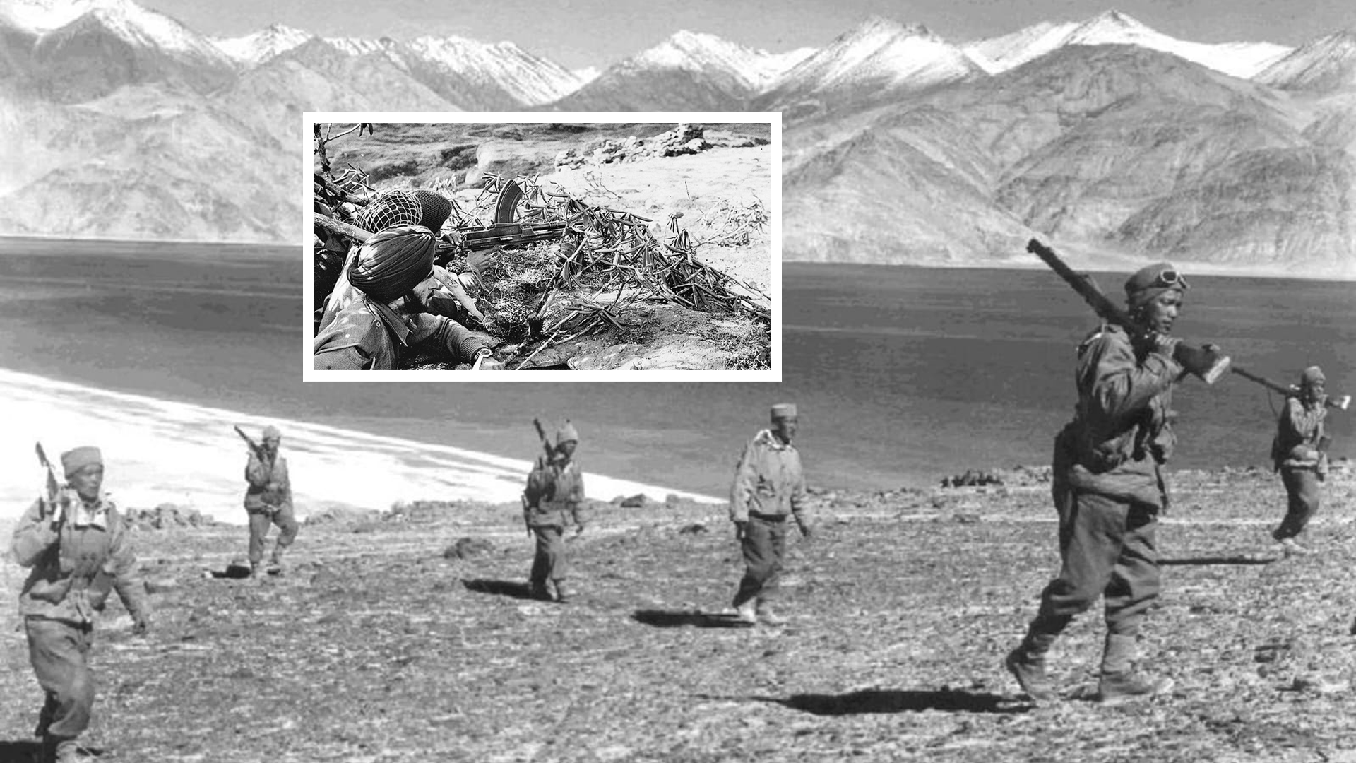
 Let the record speak plainly. The following is a consolidated statement of Nepal’s formal positions and the evidence underpinning them:
- 01 – Treaty Primacy: Under the Treaty of Sugauli (1816), all territory east of the Kali River including Limpiyadhura, Lipulekh, and Kalapani is Nepali sovereign territory. Nepal’s Ministry of Foreign Affairs has consistently reiterated this position: the government remains “fully clear and firm” that these areas are integral parts of Nepal.
- 02 – Cartographic Evidence: British Surveyor-General maps from 1827 and 1856 clearly depict the Kalapani area as Nepali territory. The 1834 SDUK map shows the source of the Kali River flowing through the Byans Valley i.e., from Limpiyadhura. The Qing Dynasty’s own maps (1903) confirm this source, labelling the territory Nepal.
- 03 – Hydrological Principle: Under internationally accepted conventions for river boundary determination, the source of a river is defined as the tributary with the longest course or greatest volume. By both measures, Limpiyadhura not the smaller Kalapani stream qualifies as the source of the Kali, placing the border where Nepal says it should be.
- 04 – Unlawful Bilateral Agreements: Both the 1991 India-China reopening of the Lipulekh Pass and the 2015 joint statement designating it as a trade point were conducted without Nepal’s knowledge or consent. No bilateral agreement between two states can legally affect the sovereign territory of a third state. Nepal has formally objected to both China and India through diplomatic channels.
- 05 – Constitutional Entrenchment: In June 2020, Nepal’s parliament unanimously approved a constitutional amendment incorporating Kalapani, Limpiyadhura, and Lipulekh into the official political map. This was not a unilateral escalation it was the formal constitutional assertion of a centuries-old treaty right, prompted by India’s unilateral road inauguration.
- 06 – India’s Own Admissions: India formally acknowledged the existence of the boundary dispute in 1996. A Joint Technical Boundary Committee has been meeting since 1981. India agreed at prime-ministerial level in 2000 to complete field demarcation of outstanding boundary areas by 2002. None of this happened. India’s persistent refusal to negotiate is itself evidence that it cannot defend its position on the merits.
- 07 – The 2026 Mansarovar Yatra: India’s announcement in April 2026 of the Kailash-Mansarovar pilgrimage route through Lipulekh facilitated by China once again activates Nepal’s sovereign objection. Nepal’s Foreign Ministry has formally conveyed its concerns to both Beijing and New Delhi, reiterating that Lipulekh is Nepali territory and that no pilgrimage, trade, or construction activity can be conducted there without Nepal’s consent.
- 08 – Encroachment Across the Border: The Kalapani-Lipulekh dispute is not an isolated case. Independent surveys estimate that India has encroached upon over 605 square kilometres of Nepali land across 71 locations in 21 districts. Nepal’s territory is not shrinking through natural processes it is shrinking through systematic, incremental occupation.

No honest accounting of this dispute can exempt Nepal from a share of the responsibility for how far it has deteriorated. Nepal’s diplomatic response, across successive governments of every political stripe, has been chronically underpowered relative to the gravity of what is at stake. Diplomatic notes have been filed and never followed up. When Nepal issued its updated constitutional map in 2020, it was not formally transmitted to China, India, or the United Nations a glaring omission that stripped the gesture of much of its international legal weight. Perhaps most startlingly, it has been reported that when Nepali prime ministers meet their Indian counterparts at the highest levels of bilateral diplomacy, the Kalapani issue is often not raised at all. The pattern has been consistent: loud rhetoric at home, polite silence across the border. Border expert Buddhi Narayan Shrestha, former Director General of Nepal’s Land Survey Department, has been blunt in his assessment Nepal’s lax diplomacy has allowed a resolvable dispute to fester into a structural problem. The current government of Prime Minister Balen Shah represents a potential turning point. As Kathmandu Mayor, Shah was forthright in condemning the India-China Lipulekh agreement as an encroachment on Nepali sovereignty, even cancelling a China visit on moral grounds when Beijing published a map that reflected Nepal’s old, smaller boundaries. Now, as prime minister, he must convert that principled rhetoric into the sustained, evidence-based diplomacy that this issue demands beginning with his upcoming visit to India, where former ambassador Tanka Karki and others have urged him to raise the matter directly and firmly.
 The Kalapani-Limpiyadhura-Lipulekh triangle is not merely 335 square kilometres of high-altitude terrain. It is the point at which the strategic interests of two of the world’s most consequential rising powers India and China converge on the sovereign space of a small, landlocked democracy. And in that convergence lies a danger that both New Delhi and Beijing would be wise to take seriously.
Nepal, pressed from three sides by its much larger neighbours, is precisely the kind of strategically vulnerable small state that external great powers have historically exploited to gain leverage in regional competitions. The longer this dispute festers unresolved the longer Nepal’s sovereignty is demonstrably compromised by its neighbours’ unilateral actions the more attractive Nepal becomes as a theatre for external interference. Global powers with competing visions for the Indo-Pacific will not hesitate to offer Nepal the recognition and the defence guarantees that its neighbours have withheld, in exchange for strategic positioning on India’s northern flank and China’s southern one. India and China, for all their rivalry, share one overriding interest in the Himalayan neighbourhood: keeping it free of external great-power interference. A Nepal that feels betrayed by both its neighbours denied justice on its own territory by the very states that lecture the world about sovereignty is a Nepal susceptible to exactly the kind of external overtures that would destabilise the entire region. The cost of resolving this dispute equitably is trivially small compared to the cost of losing Nepal’s genuine trust and neutrality. 
There is a resolution available one that does not require any of the three parties to abandon face. It requires only that they apply the same principles of international law and good-faith negotiation that each of them champions in other forums. The roadmap is straightforward: India must agree to formal, time-bound technical negotiations on the Kalapani-Limpiyadhura-Lipulekh boundary, on the basis of the 1816 Sugauli Treaty text and the full body of historical cartographic evidence not selectively curated British administrative records, but all the maps, all the surveys, all the hydrological data. The Joint Technical Boundary Committee framework already exists; it needs political will, not new institutions. China must acknowledge explicitly and formally that Lipulekh Pass lies in disputed territory whose final status has not been determined between all three states sharing that trijunction. Any trade, pilgrimage, or infrastructure arrangement through Lipulekh must, pending resolution, require Nepal’s express consent. The 1961 Nepal-China Boundary Treaty itself places the trijunction at Tinkar south of Lipulekh a point that actually complicates India’s claim, not Nepal’s. Nepal must match its principled position with the diplomatic professionalism it deserves. The constitutional map must be formally transmitted to the United Nations and to both neighbouring capitals with accompanying legal memoranda. The evidence cartographic, hydrological, historical must be presented systematically in every bilateral meeting, at every level. A dispute this important cannot be raised only when newspaper editors ask why the government is silent. 
Three leaders sit at the apex of this triangle. A fresh Prime Minister Balen Shah, carrying the democratic mandate of a new Nepal, has the moral authority and the personal credibility to raise this issue without the baggage of past political compromises. Prime Minister Modi commands the political capital to make a territorial concession that no previous Indian PM dared and to frame it as a historic act of regional statesmanship. President Xi Jinping, who has spoken of a “community of shared destiny,” has the opportunity to demonstrate that China’s neighbourhood policy is not merely transactional. The window is open. A small act of justice giving Nepal what its 1816 treaty unambiguously guarantees could secure the goodwill of a strategically placed nation for a generation. The alternative: a slow drift toward a crisis that will be far more costly to manage than to prevent.